Visit Plymouth and Cape Cod, MA
We started out by stopping at an RV dealer. Looking for one of those maps to put on the RV to mark where we’ve been. No luck! Next getting fuel and the rains came! By the time we got to Plymouth at the info centre it was just drizzling. In about 10 minutes we had a history lesson on Plymouth, where to visit and what’s free and not.
Otherwise known as a Traffic
Circle
First stop Plymouth Rock! Not quite what we were expecting. A large rock inscribed 1620 with pillars and a
roof over it. I guess just marking the
spot where the Pilgrims first landed. We wanted to see the Mayflower II but she
was in dry dock for restoration.
Plymouth Rock
The National Monument to the Forefathers built 1897 and standing 81 feet
tall, now that was impressive!
We drove past some of the other buildings in town and down
main street then headed towards Cape Cod but first stopped at a pink building,
Marylou’s Coffee House for refills and pastry.
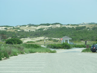
Cape Cod is about 60 miles to the end where we found the National Park
Visitor Centre with a viewing platform.
We drove out to Race Point Beach, the most northerly point, and dipped
our feet in the Atlantic Ocean. Then
back and around to Herring Cove Beach.
Entrance
to Park
At the edge of Provincetown is a plaque where the Pilgrims
landed. Behind us in the picture is a
breakwater and at high tide it can be under water.
Provincetown was having a Portuguese festival. The sun had already come out and people were
packing the streets which are one way only.
We found a quaint Bistro and ate outside. We walked along Commercial street and then
along the dock. This place thrives on
tourists and there is a fast ferry that takes 45 minutes from Boston.
Daily Stats:
Today's distance: 335 km
Weather: Rain then Sunshine with clouds; High: 27 degrees; Lo: 22 degrees
Diesel Price: $3.859 gallon and Reg. Gas $3.599
Campsite: KOA Boston/Cape Cod
Walking: 6 km
Today's news event: “Haboob” dust storm in Arizona
Note Spelling: Plymouth and Plimoth


No comments:
Post a Comment