Wednesday 31 July 2013

Day 64 Travel Halifax to North Sydney, NS

July 22

Travel Halifax to North Sydney, NS

Met some BCer’s last night in the campsite and they thought they would be the only ones from BC but there were two other vehicles from BC in the campsite as well as us.  Of course they know of Kitimat, since they have relatives living there.  Traveling to Newfoundland,  we found out that some people do not want to do the long ferry ride so are putting their RV’s in storage and flying over then renting a car and using B&B’s.   Another couple we met are leaving their RV’s in storage in North Sydney, taking the ferry over and then B&B or hotels while there.
Last night in Halifax, full moon
Leaving Halifax back through Truro then onto the TCH to Antigonish.  I like that name.  In 1999 we stopped there over night and went to a little converted school house to have a great lobster dinner.  The new highway bypasses the town so I didn’t see the restaurant that was along the highway.  We stopped in Aulds Cove so Marg & John could pick up a lobster sub for lunch.  We already had ours.  Leaving the parking lot, we almost got side swipped!!  The guy was watching traffic to cross the highway and not us pulling out. 
To get to Cape Breton Island you cross on the Canso Causeway.  It is 244 M wide and an estimated 10 million tons of rock were used to build it.   We drove to St. Peter’s Canal, a national historic site of Canada.  We sat on the rocks near where people were fishing and ate our subs.  Then we walked along the water way to the locks on the canal.  It took 15 years to blast and dig an 800 meter long passage through the solid granite hill from 1854 to 1869.  It is the only double “V” lock system in N. America.  Bras d’Or Lake is the largest N American salt water lake which saved the sailors 60 miles of travel by going through Lake Bras d’Or and avoiding the Atlantic Ocean to get to the Newfoundland fishing grounds and trading. 
 
St. Peters Canal Lock
Some road construction going on near Soldiers Cove but we got there just as the long line of one way traffic was following the pilot car.  Going through Big Pond we stopped at Rita MacNeil’s Tea House to have tea and dessert.  We camped for the night in North Sydney at the Arm of Gold RV Park.  Very nice and clean.  Beautiful sunset.
Sunset at Arm of Gold campsite

Daily Stats: 
Today's distance: 424 km 
Weather:  Sunshine with clouds; High: 26 degrees; Lo: 19 degrees
Diesel Price: $135.8 and Reg Gas $141.8/lt
Wildlife:  Deer
Campsite:  Arm of Gold RV Campground, North Sydney, $36.95 – full hookups
Walking: 5 km

Today's news event: William & Kate (Middleton) baby boy 8 lb 6 oz

Ferry rate: $388 one way (40 – 50 ft long & over height) N Sydney to Port au Basque 6 hours
Argentia to N Sydney (14 hours on ferry & as above) about $1400 with cabin one way 

Thursday 25 July 2013

Day 63 Visit Peggy’s Cove, NS

July 21 

Visit Peggy’s Cove, NS

Left the campsite heading south towards St. Margaret’s Bay Region.  Beautiful road hugging the coast with little fishing villages along the way.  As we were traveling I spotted a house that was painted on the side with a mural and a very picturesque little Light House with "Peggy’s of the Cove" on it.  The owner, artist and writer came out and talked to us when Ross was taking pictures.
Just before Peggy’s Cove is the monument that was erected for the SwissAir flight 111 that went down off the coast Sept. 2, 1998. Peggy’s Cove became popular as the community helped with the salvage efforts.  The area is very popular with artists and also Peggy’s Point Lighthouse.
We found parking at the info centre then walked across the street to William E. deGarthe’s house which is now a Gallery and Fisherman’s monument.  He sculpted it into the granite by his house and it is about 20 feet wide by 6 feet high.  
 The name Peggy’s Cove is likely from St. Margaret’s Bay, Peggy being short for Margaret.  In 1766 it is said that Samuel de Champlain named it after his mother, Margarite.  The other story  is that the sole survivor of a ship wreck was brought here, and then fell in love and married a resident so it was referred to as Peggy of the Cove.   The lighthouse has a red light in it.
Ross & I headed to Halifax to get an oil change on the truck.  Only had 4% left so we headed to a Quick Lube.  Who knew they were so popular on Sunday’s!  We were 6th in line but they were all small cars and they had 3 bays.  After the truck was done we spotted a Subway so picked up a Lobster sub for tomorrow’s lunch and then we saw a McDonalds so grabbed a McLobster.
 
Daily Stats: 
Today's distance: 126 km 
Weather:  Sunshine with clouds and a little breezy; High: 26 degrees; Lo: 19 degrees
Diesel Price:  $131.8 / litre and reg. Gas $136.8/litre
Campsite:  Woodhaven RV Park
Today's news event:  New King in Belgium 
Yesterday weather event:  Cambridge Narrows in NB had a tornado touch down 

Thanks to Chris Knight for suggesting some of our side trips.  I think we have done them all except one.

Day 62 Visit Halifax, NS

July 20

Visit Halifax, NS

We headed for the Halifax wharf boardwalk this morning.  First stop the indoor market.  Just inside I practically ran into Josie Wakita.  She’s in Halifax visiting her daughter Jaclyn and they were just out for a morning run.  We walked and talked then they had to run off so we continued along the boardwalk. 

The boardwalk is amazing.  There were huge sailing yachts tied up along the docks, historic ships, and tour boats plus Theodore the Tug taking people on harbour tours.  There was also a solar catamaran in the harbour on a scientific world tour that started in Switzerland.
 We spent time at the Maritime Museum, which has amazing displays and information on Halifax including the big fire and harbour explosion Dec. 6, 1917.  The museum admission included access to the CSS Acadia which stands for Canadian Survey Ship or Canadian Scientific Ship.  Acadia was first launched in 1913 built in England specifically for surveying Canada’s northern waters and then charting the waters around Newfoundland when it joined confederation in 1949.  She served for 56 years.  She also served in the Royal Canadian navy in both world wars.
 We walked up to the Halifax Citadel on the way up we passed Government House which had bag pipe players and changing of the guards out front since it was open for free tours but we didn’t go in.  Very impressive building!  It was getting very hot.  Marg stayed inside in the cool movie room while Ross, John and I checked out the grounds.  Fort George was built in 1749 to protect the Protestant settlers from raids by the French, Acadians, and Wabanaki or Mi’kmag. While never attached it was a strategic fort positioned at the harbour entrance.  We saw a demonstration of firing arms and a cannon being lit and fired.


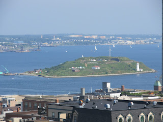
George’s Island
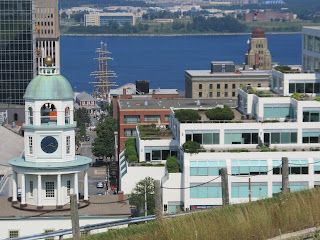
So many pictures today and definitely a must place to visit.  Of course the beautiful weather helps.  Loved the town clock built so that no one would be late for work!!  No excuses!!

Daily Stats: 
Today's distance: 97 km 
Weather:  Sunshine; High: 35 degrees; Lo: 19 degrees
Campsite:  Woodhaven RV Park
Walking:  10 km

Monday 22 July 2013

Day 60 & 61 Travel days Fundy Natl Park, NB to Middleton, NS to Halifax

July 18 & 19 

Thurs., July 18  Fundy Natl Park, NB to Middleton, NS

Driving along the Bay of Fundy this morning the tide was still in.  What a difference a day makes!  The best part is the Petitcodiac River is the shores looking like rich creamy chocolate.  The city of Moncton has grown since we were here in 1999 but it was an easy drive through.  It will be interesting to compare our pictures. 
Looks like a Chocolate River
The Welcome Centre in Nova Scotia after leaving New Brunswick is a great place to stop.  Lots of space for parking and a great picnic site plus the information available with very helpful staff and the gift shop.
The town of Stewiacke has a sign “You are now ½ way between the North Pole and the Equator.”  We stopped at the side of the road for lunch, no rest areas or pull offs on Hwy 14W.  As we were leaving 5 small convertible MG type sports cars went by us and two Harley’s.  We followed them until they headed back to Halifax and we continued along the NW coast. 

Daily Stats: 
Today's distance: 452 km 
Weather:  Sunshine with clouds; High: 28 degrees; Lo: 21 degrees
Diesel Price:  $1.354 and Reg Gas $1.374 in Truro, NS
Campsite:  Sunnyvale Estate RV Park, Middleton, NS $28.75 (W & E)
Highway 104 Toll: $4/car & $5.25/RV                

The Stars on houses I was told was called "Primitive Design".

 
Fri., July 19   Travel from Middleton to Halifax, NS 

Rain this morning when we left!  That’s a first in a long time.  Good thing we were hooked up just had to put up the jacks.  We stopped in Middleton to see their Water Clock and how it works.  We headed for Fort Anne a National Historic Site in Annapolis Royal.  Good thing it stopped raining while we toured the outside grounds and when the rain returned we rain inside to see the museum.  A beautiful little town on the north side of Nova Scotia, on the Bay of Fundy, with lots of history and very old buildings.  It was the capital from 1710 until 1749 when Halifax was founded.  The French built the fort in the 1630’s but then the British took over.  The Scots had it then from 1621 - 1629.  The French reclaimed it and built 4 forts.  When the British took control in 1710 they renamed it after Queen Anne.  The community’s main industry in the 1700 – 1800’s was ship building.
Fort Anne Powder Room in back ground
We stopped in Yarmouth long enough to get gas and groceries.  It was cool and windy here so time to go.  There are scenic highways that take you along the coast but that would have taken too long.  So we only drove into Lunenburg to see the Bluenose II.  It was in dry dock still being reconstructed so we could only see it through the fence.  Another town that we would have liked to spend more time in!
 
Bluenose II under reconstruction
One thing I do like about Nova Scotia highways is their large signs indicating the area and large signs with plenty of notice for towns and special places.  The fog was dense in places and it cooled off.  We found our campsite in the fog but at least the breeze was warm.
 
Daily Stats: 
Today's distance: 452 km 
Weather:  Rain then cloudy, foggy portions; High: 22 degrees; Lo: 17 degrees
Diesel Price:  $1.344 and Reg Gas $1.404 in Yarmouth, NS
Campsite:  Woodhaven RV Park
Wildlife:  Deer
St. Anne Style:  a Vauban-style fort


Nova Scotia Stats:
Nickname:  Bluenose Country
Flower:  Mayflower
Bird:  Osprey 

Day 59 Visit Hopewell Cape, NB

July 17 

Visit Hopewell Cape

Cape Enrage is well worth the visit and the $5 admission fee.  First the park interpreter gave us the history on the area the light house is still maintained by the Coast Guard and was manned but has been automated like most light houses.  For those so inclined there is zip lining and rock rappelling.  On this beach you find slabs of rocks as they come loose from the cliff.
At Mary’s Point there is a lighthouse, Anderson Hollow Lighthouse that has been moved 6 times to come to its final resting place.  The history in this area was ship building and on the beach is an outline of a ship 196 ft long to give the feel of the size of the ships that were built. 
The best time to visit the Hopewell Rocks is at low tide so you can walk on the ocean floor.  Low tide today was 13:45, perfect timing.  We walked as far as we could, to the rock wall and emergency tower (in case someone gets caught out there) and on the way back tried to identify the rock shapes.  The Hopewell Rocks are referred to as the Flower Pots and I remember the Bear Rock from 1999 when we were here with Ross’ parents. 
Bear Rock & Love Arch
After that long walk it was time for a late lunch so we had the Seafood Chowder and a Lobster Club.  We were going to walk to a couple view points when it started raining.  We went to the closest one, Daniels Flats which is 2 ½ km wide when the tide is out.  Love those chocolate looking shores!
The rains didn’t last long.  Back at the campsite we found a trail Kinnie Brook so followed it down into a little valley with 100 stairs to the bottom.  The creek bed was dry so back up 100 stairs to have supper.  We got to sit by the fire about an hour when the rains returned.

I’ve noticed when driving around a lot of the houses or garages have a large star on it.  Is it just decoration?  Patriotic due to the star on the Provincial flag?  I will have to ask.

Daily Stats: 
Today's distance: 125 km 
Weather:  Sunshine; High: 24 degrees; Lo: 19 degrees
Wildlife:  bunny
Campsite:  Chignecto N Campground Fundy National Park
Walking:  6 km
Today's news event: The price of gas is increasing Thursday, diesel by 1 cent & regular gas by $.045 per liter

Day 58 Travel Saint John, NB to Fundy National Park of Canada

July 16 

Saint John NB to Fundy National Park of Canada

Leaving Saint John we head on Hwy 111 on the Fundy Coastal Drive to St. Martins to view the caves.  We weren’t exactly sure where they were so we stopped and asked where people were setting up tables.  We found out a cruise ship was in Saint John and about 9 buses were heading this way with tours.  We went through a covered bridge and 1 km down the road; a large parking lot and a restaurant advertising “World Famous Seafood Chowder.”  Of course we tried the chowder after checking out the caves.
Covered bridge

Tides out, caves accessible
Our plan was to head to Moncton, then travel to the Hopewell Rocks and sights in between.  But we decided to just camp in Fundy National Park that way we see more of the park as well.  The GPS is programmed and it takes us on a short cut, when the road turns to gravel we decided this is not the road we want to take with the RV’s.  It was getting scary.  So back we went to Sussex Corner and followed the highway signs instead.  Arriving at the park there were sites available in Chignecto North campground, treed gravel sites.  After a quick lunch we headed to Point Wolfe with a quick stop at Buttland Lookout and Dickson Falls.  We hiked the Coppermine Trail 4.4 km and then down to the beach 1 km.  Then we drove to Herring Cove for another great view of the Bay of Fundy and travel through another covered bridge built in 1992.  

Daily Stats: 
Today's distance: 219 km 
Weather:  Sunshine; High: 28 degrees; Lo: 22 degrees
Wildlife:  Bunnies
Campsite:  Chignecto North campground $32.30/night and $6.60 wood canvas bag full
Walking:  5.4 km plus
Today's news event:  Discussion on Harper’s leaked email “Enemies List”

Day 57 Visit Saint John, NB

July 15

Visit Saint John, NB

First stop an RV dealer to find parts for John’s trailer.  There was a listing for an RV dealer on our campsite map.  Program the GPS and we find nothing.  Pull into a gas station to get directions and there is a truck filling up with the name of the RV place we are looking for.  Since the new highway has come to Saint John from the US border the roads have changed.  Got the parts and headed for downtown Saint John.  Found parking then walked to Market Square at the Waterfront. 
Across the street is Barbour’s General Store, a restored 18th century general store.  Then we walked to Saint John’s City Market.  The roof is built like an inverted hull of a ship to represent the city’s past ship building history.  It is also the oldest Farmers Market open every day since 1876.  
Saint John became the first incorporated city in Canada in 1785.  We stopped briefly at the Fort Howe Lookout built by the British in 1777 to protect the area from American privateers and native unrest.  The building has been reconstructed and has a panoramic view of the harbour and city.  The Reversing Rapids are a must see at high tide and low tide.  The Reversing rapids are created when at low tide the St John River flows down to the ocean through a 137 meter wide gorge.  At slack tide the waters are quiet. At high tide the river reverses going back up stream.
Low Tide flowing out
 From the downtown you can see a round tower across the way.  Driving past the Reversing Rapids we headed to the Carleton Martello Tower National Historic site of Canada and decided to buy a Parks Canada Discovery Pass.  This tower was built to protect the Saint John harbour for the War of 1812 was wasn’t completed until 1815.  The tower remained in use until 1944.  Good thing it was never really needed that’s why it is still in great shape today.
Inside Tower
We went back downtown to have a late lunch on the wharf boardwalk, a lobster roll.  Then we walked around King’s & Queen’s park; past the No 2 Engine House/Firefighters Museum housed in an 1840 firehouse; The Loyalist House, the oldest building in St John built in 1811 by David Daniel Merrit, a Loyalist from New York; the old churches; the old houses and buildings.  Then we drove back to the Reversing Rapids to see the river running upstream.
High Tide flowing in
Last but not least we had to return to the campsite so John could fix his trailer to get back on the road.  Ross helped by supervising and reading instructions.

Daily Stats: 
Today's distance: 125 km 
Weather:  Sunshine; High: 29 degrees; Lo: 22 degrees
Diesel Price:  $1.379 litre (Back in Canada and prices jump)
Wildlife:  Heron
Campsite:  Rockwood Park Municipal Campground $35/night full hookups
Walking:  6 km

Today’s News:  Harper Cabinet Shuffle & email leaked about an Enemies List (who cabinet can and can’t talk to)

Day 56 Travel Day Trenton, ME to Saint John, NB

July 14

Acadia National Park (Trenton, ME) to Saint John, NB

Don’t know sometimes if taking the short cut is the best way to go since the highways are usually worse and slower.  But leaving Trenton we headed towards Bangor on 1A but cutoff on 179 North towards 9 East taking us to New Brunswick.  It does save us time although the road is slower and definitely bumpier! 
Along Hwy 179 in Maine
Back in Canada the Customs Officer just asked, “How long were you in the USA? How much did we spend and do we have any fire arms and alcohol?  Have a nice trip!”  First stop downtown St. Stephen Visitor centre.  We got enough information to keep us here a month or more. St Stephen is on the St. Croix River which is the border between Canada and Maine and also has tides up to 24 feet (7 meter) every 6 hours.  The creation of the chocolate bar is reputed to have happened locally at the Ganong Bros. Candy factory in 1906.  Of course we had to walk down the block and get some chocolate.  The museum is next door but we had to get going. 
Town of St Stephen, NB across from info centre
First off we had to stop at St Andrews by-the-Sea which is on Passamaquoddy Bay.  Around the turn of the 20th century it flourished as Canada’s first sea side resort town.  The beautiful Fairmont Algonquin hotel built in 1889 still stands today.  The picnic site at the end of town is on the bay and across the street is a Kiwanis campground.  The tides here are about 25 feet.  
Our lunch spot 
 Arriving in Saint John we decided to stay at Rockwood park, one of Canada’s largest municipal parks.  As John was driving by us we heard his trailer making noise and when he backed into his site it was worse.  The rear passenger side brake on the trailer was broke!  Oh well, we’ll worry about that in the morning.  After dinner we walked up to a view in the park overlooking part of the city and met two girls travelling from Denmark.  They were tenting and travelling without a car.  They said they were getting around thanks to the kind and generous Canadians!
Rockwood Park overlooking Saint John

Daily Stats: 
Today's distance: 317 km 
Weather:  Sunshine with clouds; High: 31 degrees; Lo: 21 degrees
Wildlife:  Heron, falcon, kingfisher
Campsite:  Rockwood Park Municipal Campsite – Full hookups $35.00/night
Walking:  2 km 
 
New Brunswick Stats:
Nickname:  Picture Province
Flower:  Purple Violet
Bird:  Black-capped Chickadee

Monday 15 July 2013

Day 55 Visit Acadia National Park in Maine

July 13 

Visit Acadia National Park

The road leading into the park is picturesque.  Acadia Natl Park is on Mount Desert Island and resembles the shape of a lobster claw.  The park loop road is about 20 miles but to take it all in you need all day.  We started with Cadillac Mtn.  The mountain is 1530’ tall and is the tallest mountain on the east coast north of Brazil.  We got there at 10 am so parking was no problem.  There is a path around the top, 360 degree view!  When we left, 2 trolley’s and 2 buses had arrived and the parking lot was filling up.  The temperature was already 27 degrees. 
Looking down on Bar Harbor 

Traveling along the east coast we came to Sand Beach, the park’s only sand beach on the ocean.  The roads here are one way so after the parking lots are full the road is lined with cars.  We took off our shoes and walked the beach.  Wading into the water is a little cool/cold.  After all it is the Atlantic Ocean.
Just a short distance down the road is Thunder Hole.  The best time to visit is when the tide is coming in to this narrow granite channel, the air becomes trapped and it makes a thunderous sound.  We were there as the tide was just starting to come in so no thunder yet.  The next attraction was Otter Cliffs that are pink granite and rise 100 feet out of the water.
We were told that a good place to stop for a snack is Jordan Pond, the only restaurant in the park.  Jordan Pond House is famous for its baked popovers and homemade ice cream.  Most meals come with a popover, fresh baked just out of the oven.  Delicious!!  After our light lunch we walked the trail to Jordan Pond to view The Bubbles, a pair of rounded mountains to the north.
Following the coast line we came to Northeast Harbor which is an active fishing harbor.  Very nice summer homes and antique type store fronts. 
Back to Bar Harbor we found 3 hour free parking.  It was great walking around the town’s main street, checking out their shops and down to the wharf to see the boats coming and going.  Cheaper lobster dinners are offered between 4 & 6 pm so we decided to eat out on the pier for $16.99.  When our dinner arrived, it looked like a plastic lobster.  But it was the real thing!

Another great day!  To finish it off we had to get some liquor before heading back into Canada.  We found a 30 Canadian beer for $20 (at home $48) and I got a 750 ml Southern Comfort and Malibu for $14 each.

Daily Stats: 
Today's distance: 125 km 
Weather:  Sunshine; High: 30 degrees; Lo: 25 degrees
Wildlife:  We didn’t see anything in the park!
Campsite:  Timberline Acres RV Park
Walking:  5 km

L.L. Bean has supported Acadia Natl Park since 2002 by donating over $3 million to support the park and the Island Explorer which has 8 bus route linking hotels, campgrounds, villages to destinations in the park.  The buses are free you just need to buy a $20 Park Pass good for one week.

Saturday 13 July 2013

Day 53 & 54 A Day to Relax & Near Boston, MA to Bar Harbour, Maine

July 11 & 12 

Thursday, July 11 – A Day to Relax

Started the morning with a little rain and then the thunder started and the skies opened!  It poured for about ½ hour.  It was so loud in the RV we had to talk very loud and we couldn’t even hear the sound on the TV.  Got some laundry done then ran into Middleboro to fill up gas and we found a AAA office and got some free maps that we were missing.  We looked for an RV dealer to find a North American map to put on the RV to mark all the states we’ve been through and all the provinces.  No big dealers nearby.
We checked our tentative travel plans and booked our ferry to and from Newfoundland.  We haven’t really had a plan so far but now we do. 

Daily Stats: 
Today's distance: 25 km 
Weather:  Thunderstorm then overcast & muggy; High: 26 degrees; Lo: 22 degrees
Diesel Price:  $3.859
Campsite:  KOA Boston/Cape Cod
Walking:  5 km
 

Friday, July 12 – Middleboro, MA to Trenton, ME 

A great day to travel, not too hot!  Head to 495 north and then 95 north to skirt around Boston.  10 am and these roads are still crazy busy.  Why aren’t these people at work??  We found that although the trees are beautiful in these states, a lot of signs are getting covered.  Highways really needs to do some trimming.  Also there are signs allowing traffic flow in the breakdown lane Monday – Friday 6 am – 10 am and then again from 3 pm until 7 pm.  That’s why vehicles are passing us on the right side.    
Merrimack River N of Boston

We didn’t even realize we would be going through New Hampshire.  Just a few miles of coast line for them between Massachusetts and Maine.  But there was a toll both in each state which cost us $8.50 for 3 tolls.  We decided to stick to the interstate until after Portland, Maine just because we had a long drive today.  Then we headed onto highway 1 along the coast.  The scenery was beautiful and the little towns very quaint but with the road going through the towns the going was very slow at times. 
At the Info Center in New Hampshire
Belfast, ME


Daily Stats: 
Today's distance: 25 km 
Weather:  Sunny with clouds; High: 27 degrees; Lo: 22 degrees
Campsite:  Timberland Acres RV Park – Full Service, WiFi, $46/night
Walking:  5 km
Today's News:  Maine wants full safety review due to the train derailment in Montreal.  Rail shipping of oil has increased over 200 per cent and the rail traffic goes from Montreal thru Maine to New Brunswick.

New Hampshire Stats:
Nickname:  Granite State
Flower:  Purple Lilac
Bird:  Purple Finch

Maine Stats:
Nickname:  Pine Tree State
Flower:  White Pine Cone & Tassel
Bird:  Chickadee