Thurs., Sept. 5
Travel Havre, MT to West Glacier National Park
When we left Havre this morning there wasn’t a cloud in the sky and it was
22 degrees. Great to see some wild life
in the fields again, a herd of deer and 4 Prong Horns but flying by too fast
for pictures. Then off in the distance
north of Chester we could see what looked like mountains but they were the
Sweet Grass Hills. I can see how the
railroad coming through here helped these small communities grow. We’ve passed four trains, long and loaded
with cargo and one was Amtrak. Driving
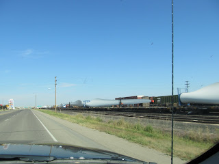
through Shelby there was a parked train with Wind Mill parts on it waiting to
be transported. Oil was discovered in
Shelby in 1922 but it didn’t last instead it grew as a hub for rail and
transportation.
Back in Blackfeet Indian Nation and their reservation has 1.5 million acres
of land. We drove through here back in
June. Wow three months ago. Lewis and Clark also traveled through here at
Camp Disappointment which now has a Historic Site marker. It was as far north as they came on their
journey. Looming ahead were storm clouds
and by the time we got to Browning, it was raining. Browning is the hub of the Blackfeet
Nation. The temperature dropped to 17
degrees from 26 at Shelby. It was
strange coming into Glacier National Park, we were here on this road 3 months
ago. The sun was back out and it was
warming up in the park. We picked the
first campsite on the highway past West Glacier entrance. Very rustic, Glacier Campground with their
logo; “The way camping used to be.” We drove into West Glacier and checked out
their shops and also went into the Alberta, Glacier National Park Interpretive
centre. In 1932 Waterton Lakes National
Park and Glacier National Park were officially joined as Waterton-Glacier
International Peace Park. Waterton-Glacier
International Peace Park became a World Heritage Site in 1995 for its scenic
values, climate, landforms, wildlife and wild flowers. We drove into the park and went through Apgar
Village. The campsite is a ¼ mile away,
no services but very nice. Too bad we
didn’t check it out instead.
Daily Stats:
Today's distance: 412 km
Weather: Sunny then rain then sun w/clouds; High: 27 degrees;
Lo: 17 degrees
Diesel: $3.93 Coram, MT, $3.899
Havre, MT
Wildlife: Herd of deer, 4 Prong Horn, 6 hawks, Magpies
Campsite: Glacier Campground $27 incl. W/E, Wi-Fi hotspot at office
Walking: 3 km
Monday, 9 September 2013
Day 108 Travel Williston, ND to Havre, MT
Wed., Sept. 4
Travel Williston, ND to Havre, MT
Wow, new paved road for about 10 km. Yesterday they were at our exit at 4 pm. I can see why they are putting in new roads, this area needs an interstate for the amount of traffic. Once we are through Williston about 10 miles we gain back another hour. A short distance into Montana on Hwy 2 all the oil rigs etc. disappear. Then about 110 miles through Reservation land and there is nothing, a very boring drive. Oh yes and road construction on gravel for about 5-10 miles.
We certainly noticed the difference in roads; it felt like we were driving on a train track. The small town of Wolf Point is known for farming but especially honey about 4,000 bee colonies produce about ½ million lbs of honey. We stopped in Glasgow for diesel and it had started to rain. I ran into grab coffees and because I brought my own mug or refill it was $.25 and using one of their cups was $1. Cheapest coffee ever and it was pretty good.
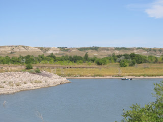
Ft Peck Lake is massive when in the 1930’s the dam was built by the US Army Corps of Engineers it provides electric power, irrigation and recreation. There are a few smaller reservoirs along this route, Nelson Reservoir near Malta and where the landscape is getting a little greener. Havre is a small city and got its beginnings as a transportation hub where the railroad brought supplies for the miners, trappers, and the military at the nearby Ft. Assiniboine. Not much left of this fort either, a sign on the highway and a few buildings. There were 2 campsites in Havre but right on the main road so we decided the one that advertised “quiet” would be good. It didn’t look like much but it was good for the night and at least 6 very big rigs pulled in after us.
Daily Stats:
Today's distance: 546 km
Weather: Sunny; High: 29 degrees; Lo: 19 degrees
Diesel: $3.97 Gal; Gas $3.67 Glasgow, MT
Wildlife: 2 Pelicans, Cdn geese, ducks
Campsite: Evergreen Campground $33 W/E and WiFi
Walking: 2 km
Day 107 Visit Williston, ND & Fort Buford State Historic Site
Tues., Sept. 3
Visit Williston, ND & Ft Buford SHS
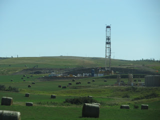
It’s hard to believe that these golden fields used to be overrun with buffalo. Now we don’t see any wildlife, some cattle, fields of hay and wheat and everywhere you look there’s a drilling devise and/or tanks and piles of sand to create bases for all this drilling. AB & SK have nothing on these guys. On our way to Fort Buford we had to drive through Williston which started out as a railroad town. Huge industrial section! On the east side of the city the highway is being paved and on the west side it’s getting concrete road about a foot thick.
We visited the Missouri/Yellowstone Confluence interpretive centre just a few miles SW. The centre covers Lewis & Clark expedition, fur trade, modes of transportation and the areas geology (fossils). Just down the road is Ft. Buford established in 1866 and dismantled 1895. Entry fee of $5 is good for both sites. At Ft Buford there are only 3 buildings remaining of which two have been reconstructed. Only the powder magazine is original. The main historical significance is Chief Sitting Bull surrendering his rifle in 1881 in the officer’s quarters.
A quick drive around Williston and back to the campsite to enjoy the sunshine and heat. The paving crew was at the exit to the campsite, boy they cover a lot of ground. We were amazed when we drove by the marina, the parking lot was empty compared to yesterday and the campsite had less RV’s as well. There were still a few tenters but our little corner was almost empty.
Weather: Sunny; High: 33 degrees; Lo: 22 degrees
Wildlife: Hawk, pelicans
Campsite: Lewis & Clark State Park $25/night with W/E and Wi-Fi works
Walking: 5 km
Visit Williston, ND & Ft Buford SHS
It’s hard to believe that these golden fields used to be overrun with buffalo. Now we don’t see any wildlife, some cattle, fields of hay and wheat and everywhere you look there’s a drilling devise and/or tanks and piles of sand to create bases for all this drilling. AB & SK have nothing on these guys. On our way to Fort Buford we had to drive through Williston which started out as a railroad town. Huge industrial section! On the east side of the city the highway is being paved and on the west side it’s getting concrete road about a foot thick.
We visited the Missouri/Yellowstone Confluence interpretive centre just a few miles SW. The centre covers Lewis & Clark expedition, fur trade, modes of transportation and the areas geology (fossils). Just down the road is Ft. Buford established in 1866 and dismantled 1895. Entry fee of $5 is good for both sites. At Ft Buford there are only 3 buildings remaining of which two have been reconstructed. Only the powder magazine is original. The main historical significance is Chief Sitting Bull surrendering his rifle in 1881 in the officer’s quarters.
A quick drive around Williston and back to the campsite to enjoy the sunshine and heat. The paving crew was at the exit to the campsite, boy they cover a lot of ground. We were amazed when we drove by the marina, the parking lot was empty compared to yesterday and the campsite had less RV’s as well. There were still a few tenters but our little corner was almost empty.
Daily Stats:
Today's distance: 160 kmWeather: Sunny; High: 33 degrees; Lo: 22 degrees
Wildlife: Hawk, pelicans
Campsite: Lewis & Clark State Park $25/night with W/E and Wi-Fi works
Walking: 5 km
Day 106 Travel Minot, ND to Williston, ND
Mon., Sept. 2
Travel Minot, ND to Williston, ND
It was a little cool in the morning when we left and that made the RV cooler for sleeping. On the out skirts of Minot was a field with old rusting 40’s & 50’s cars and trucks. What a shame! The terrain here reminds me of Medicine Hat with their coulees.
About 20 minutes out of Minot the terrain is flatter with lots of small ponds. Then the farmland takes a dramatic change, there are oil donkeys everywhere drilling for oil! We are now in the “oil patch.” Turning onto Hwy 8 South near Stanley there are more Embridge storage tanks and RV camps for the workers. It just seems like this boom is growing so fast that camps spring up willy nilly. In New Town we stopped for gas and this town is really willy nilly. What a mess! This small highway is as busy as an interstate.
As we pulled into Lewis & Clark S P the RV’s were slowly pulling out. The campsites have water and electricity so all these big units were in line for the sani. Once all the commotion was over there were about 15 units compared to the full site of over 73 plus 2 cabins. Cell service was poor but internet worked great. We got the bikes out and rode to the beach, marina and around the campsite. The marina parking lot was full of vehicles and boat trailers. Grass hoppers flitting and hopping about but not a nuisance. The nuisance were the flies landing on everything. It was hot sitting out in the sun reading, up to 38 degrees and 30 in the shade.
Daily Stats:
Today's distance: 226 km
Weather: Sunny; High: 38 degrees; Lo: 14 degrees
Diesel: $3.99 in New Town, $3.69 gal gas
Wildlife: Harrier Hawk, Bee Hives
Campsite: Lewis & Clark State Park $25/night with W/E and Wi-Fi works
Walking: 5 km riding & 2 km walking
Note: Sept. 2 Anniversary date of Swiss Air 211 crashing in the ocean just off Peggy’s Cove
Wednesday, 4 September 2013
Day 105 Travel Bismarck, ND to Minot, ND
Sun., Sept. 1
Travel Bismarck to Minot, ND
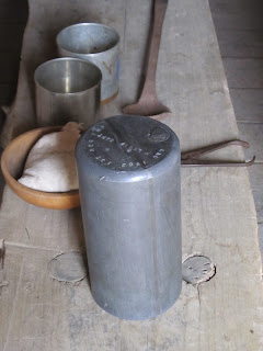
North of Bismarck are rolling prairies, hay, corn and sunflower fields even a windmill farm. We visited another Lewis & Clark Interpretive Centre at Fort Mandan. This fort was built across the river from the Mandan Indian Village and just completed on Dec. 24, 1804 and the expedition lives in it until April 1805 when they head west. The camp had 44 men and in the spring about 33 headed west with Seaman, Lewis’ Newfoundlander dog. Jeff, the interpreter did an excellent job of explaining details of the camp. A lead canister was filled with gun powder and plugged with wax weighing approx. 12 lb. each. When needed they would be unplugged and the lead made into musket balls with enough gunpowder.
Today's distance: 349 km
Diesel: $3.819 Bismarck with $.08 off coupon from KOA
Wildlife: Harrier Hawk & Red Tailed Hawk, Bee Hives
Campsite: Roughrider Campground $40 w/e; new showers & laundry otherwise ???
Walking: 2 km
Note: In
1837 the white man brought small pox without knowing it to the Indians which
wiped out most villages.
Travel Bismarck to Minot, ND
North of Bismarck are rolling prairies, hay, corn and sunflower fields even a windmill farm. We visited another Lewis & Clark Interpretive Centre at Fort Mandan. This fort was built across the river from the Mandan Indian Village and just completed on Dec. 24, 1804 and the expedition lives in it until April 1805 when they head west. The camp had 44 men and in the spring about 33 headed west with Seaman, Lewis’ Newfoundlander dog. Jeff, the interpreter did an excellent job of explaining details of the camp. A lead canister was filled with gun powder and plugged with wax weighing approx. 12 lb. each. When needed they would be unplugged and the lead made into musket balls with enough gunpowder.
Seaman, Lewis’ dog
Ft Entrance
Lewis & Clark Quarters
12 lb lead canister filled with
gun powder
Then we passed something strange, a bridge over the
highway with what appeared to be a conveyor belt heading for a plant in the distance.
A sign Coal Creek Stn Power Plant, Fallkirk Mining Co gave us our clue. We stopped at the Audubon National Wildlife
Refuge but it was closed so we just walked around the building and peeked in
the windows.
Just up the highway a causeway divides Lake Audubon
from Lake Sacagawea. Lots of people out
fishing. Not too far away Minot, a
growing city of 40,000 possibly due to the oil industry booming. Our campsite was half full of worker
guys. The campsite had new spots graded
then rocks on top to make new sites. The
oxbow by the campsite was blocked off so it was covered in algae.
Diner in Minot, must be good lots of cars.
New part of
campsite
Daily Stats: Today's distance: 349 km
Diesel: $3.819 Bismarck with $.08 off coupon from KOA
Wildlife: Harrier Hawk & Red Tailed Hawk, Bee Hives
Campsite: Roughrider Campground $40 w/e; new showers & laundry otherwise ???
Walking: 2 km
Subscribe to:
Posts (Atom)


